IMPROVE YOUR EFFICIENCY WITH ADDRESS GEOCODING
Geocoding is a process of defining the coordinates of a location. Geocoding the addresses of the delivery points is an integral part of a successful and efficient transport planning operation.
Therefore, address geocoding is a standard feature of both Road Control Web Service and remote calculation in Road Control Software.
Enhancing Web Services
In addition to basic support of geocoding in Road Control we also provide two separate enhancing web services that support geocoding solutions – Search web service and a Map Component with an API interface to verify and validate address data. The services to support geocoding and address validation are available for the whole of Europe.
Batch Address Geocoding
Do you need assistance with batch geocoding? Are you having trouble validating your address database? Feel free to contact us. We will help you out to find a solution.
For a more detailed description of geocoding solutions, see the information below.
ADDRESS GEOCODING SOLUTION
Geocoding as a Feature of Road Control Software
Do you have the exact addresses of your customers? If so, you can easily import the places with the addresses to Road Control Software in *.csv or *.xls. format. If address information is included in the imported file, it is possible to use automatic address geocoding provided within the remote calculation service. After the task is sent for remote calculation, the service will automatically try to geocode all the places that have no coordinates.
Geocoding as a Feature of Road Control Web Service
Geocoding function is a feature of Road Control Web Service. RML exchange format enables you to enter the addresses of the delivery places in a structured form. Before Road Control starts to calculate the plan, all the places you entered without coordinates will automatically be geocoded.
<id>12</id>
<label>Edisonova 3047, Brno, 612 00, okres Brno-Město</label>
<country>Czech Republic</country>
<city>Brno</city>
<zip>61200</zip>
<street>Edisonova</street>
<house_number>3047</house_number>
<position></position>
Note: Automatic address geocoding provided by Road Control is not intended for batch geocoding, nor is it designed to geocode large numbers of addresses at one time. It is designed to provide geocoding of several tens of addresses as a tool enabling you to geocode new customers within your daily Road Control operation. If you need to geocode a greater number of addresses, use our Search Service and/or one-time batch geocoding (see below).
Position Services – Search Web Service
Separate web service to be integrated with your systems.
The Service provides functions for line based or structure based address and ZIP code search throughout Europe or at the level of individual European countries. Hint Function Support.
Call possibilities:
The Service available at https://services.position.cz/search/ may be called by using SOAP, by HTTP GET method with the parameters specified in URL, and also by HTTP POST method (FORM or XML). If HTTP call method is used, two types of output are available: XML or JSON.
It is possible to set the Service parameters (such as number of results, output projection, user's ID, line based or structure based output, optional fields etc. ).
High performance service available 24/7.
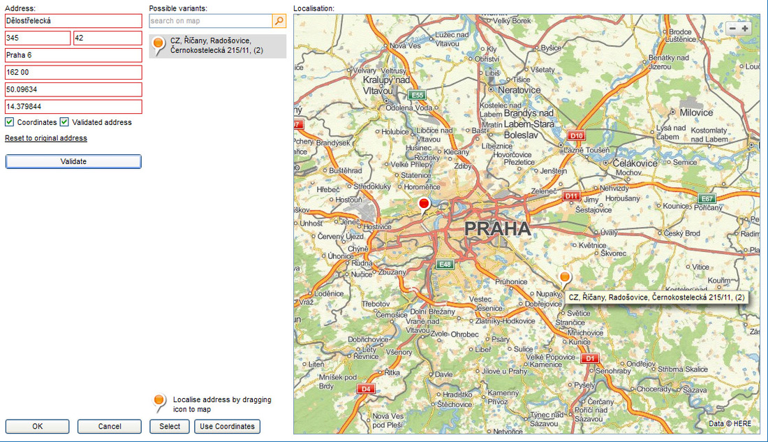
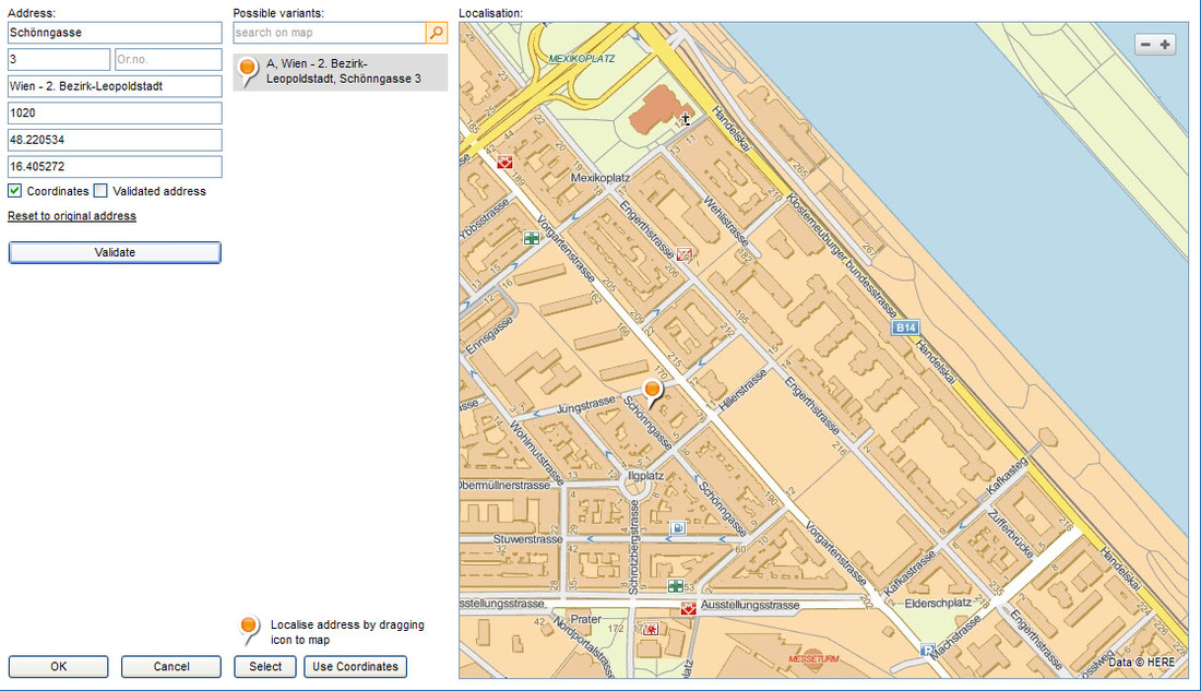
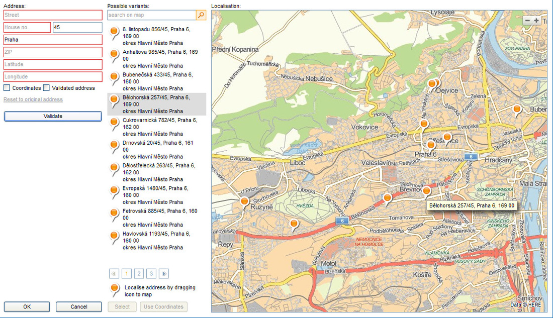
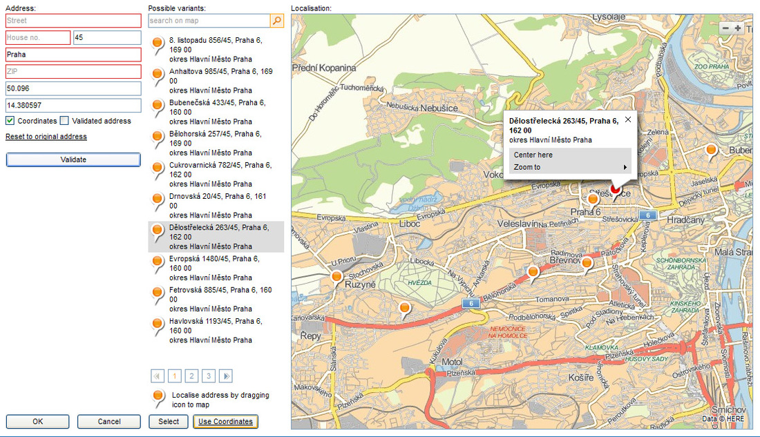
Position Services – Web Map Component Address
Position Services – Web Map Component Address (WMC Address) provides a visual map component for address validation and geocoding. The Component takes the form of an HTML application. It is primarily used when integrated with other applications (HTML or native).
Based on the input, the Component provides a user interface that makes it possible to find the relevant items in a database of addresses (streets, towns etc.) and/or to localize a place by way of marking the place on the map.
To integrate the component into the IS, following options may be used:
- JavaScript API, communication is established by calling JavaScript functions.
- URL API, communication is established by changing URL parameters.
- Windows DLL (32-bit), communication is established by calling DLL Library functions. (DLL Availability and conditions of use are available on request).
The service is available at: https://services.position.cz/wmc-address/
One-time Batch Geocoding of Address Databases
The services we provide to our clients also include initial batch geocoding of their existing address databases. It can be hundreds of thousands or millions of addresses. It will make the implementation of the Road Control Planning solution much quicker and easier. Batch geocoding service is a multilevel automated and semi-automated process done by our internal tools and know-how. Information on how accurate the geocoding was (address/street), address validation, and the suggestion of its correct form and format are also provided by the service.
As the next step to complete the batch geocoding, we recommend you to integrate the web service and to use it in routine address validation and geocoding operation.